In an era marked by escalating environmental concerns, the ability to comprehensively monitor and understand the health of our planet is more critical than ever. Satellites have emerged as indispensable tools in this endeavor, providing a unique vantage point and a wealth of data that would be impossible to obtain through ground-based observations alone. From tracking deforestation to monitoring air and water quality, satellites are revolutionizing how we assess and respond to environmental challenges.
The Power of Remote Sensing
At the heart of satellite-based environmental monitoring lies the principle of remote sensing. Satellites equipped with specialized sensors can detect and measure various characteristics of the Earth’s surface and atmosphere from space. These sensors capture electromagnetic radiation reflected or emitted by the Earth, providing valuable information about its physical, chemical, and biological properties.
Unlike traditional monitoring methods that rely on localized measurements, satellites offer a synoptic view, covering vast areas of the globe in a single pass. This broad perspective enables scientists to identify large-scale environmental patterns and trends that might otherwise go unnoticed.
Key Applications of Satellites in Environmental Monitoring
Satellites play a crucial role in monitoring a wide range of environmental parameters, including:
Deforestation and Land Cover Change: Satellites can track deforestation rates, monitor forest degradation, and map changes in land cover over time. This information is essential for understanding the impacts of deforestation on biodiversity, climate change, and ecosystem services.
Air Quality Monitoring: Satellites equipped with atmospheric sensors can measure the concentrations of pollutants such as nitrogen dioxide, sulfur dioxide, and particulate matter. This data helps assess air quality levels, identify pollution sources, and track the effectiveness of air pollution control measures.
Water Quality Monitoring: Satellites can monitor water quality parameters such as chlorophyll-a concentration, turbidity, and sea surface temperature. This information is vital for assessing the health of aquatic ecosystems, detecting harmful algal blooms, and managing water resources.

Climate Change Monitoring: Satellites provide crucial data for monitoring climate change indicators such as sea level rise, ice sheet melting, and greenhouse gas concentrations. This information is essential for understanding the impacts of climate change and developing mitigation and adaptation strategies.
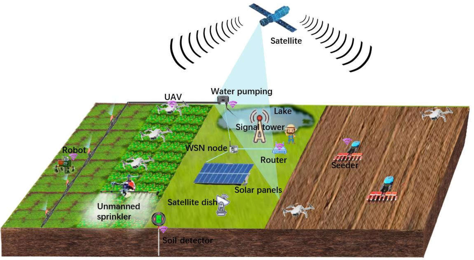
Natural Disaster Monitoring: Satellites can monitor natural disasters such as floods, wildfires, and volcanic eruptions. This information helps assess the extent of damage, coordinate disaster relief efforts, and improve disaster preparedness.
Specific Satellite Missions and Technologies
Several satellite missions and technologies are instrumental in environmental monitoring:
Landsat: A series of Earth observation satellites that have been providing continuous data on land cover and land use change since 1972. Landsat data is widely used for monitoring deforestation, agricultural practices, and urban growth.
Sentinel: A family of Earth observation satellites developed by the European Space Agency (ESA) as part of the Copernicus program. Sentinel satellites provide data on a wide range of environmental parameters, including land cover, air quality, and ocean conditions.
MODIS (Moderate Resolution Imaging Spectroradiometer): An instrument onboard the Terra and Aqua satellites that provides data on a wide range of environmental parameters, including vegetation cover, cloud properties, and sea surface temperature.
VIIRS (Visible Infrared Imaging Radiometer Suite): An instrument onboard the Suomi NPP and NOAA-20 satellites that provides data on a wide range of environmental parameters, including air quality, sea ice, and wildfires.
Hyperspectral Imaging: A technique that captures images in hundreds of narrow spectral bands, providing detailed information about the composition and properties of the Earth’s surface. Hyperspectral imaging is used for a variety of environmental applications, including mineral exploration, vegetation mapping, and water quality monitoring.
Advantages of Satellite-Based Environmental Monitoring
Satellite-based environmental monitoring offers several advantages over traditional methods:
Synoptic View: Satellites can cover vast areas of the globe in a single pass, providing a comprehensive view of environmental conditions.
Temporal Resolution: Satellites can collect data on a regular basis, allowing for the monitoring of environmental changes over time.
Accessibility: Satellite data is often freely available to researchers and policymakers, making it accessible to a wide range of users.
Cost-Effectiveness: Satellite-based monitoring can be more cost-effective than traditional methods, especially for large-scale monitoring programs.
Challenges and Limitations
Despite its many advantages, satellite-based environmental monitoring also faces some challenges and limitations:
Data Processing and Analysis: Satellite data can be complex and require specialized processing and analysis techniques.
Cloud Cover: Cloud cover can obscure the Earth’s surface, limiting the availability of satellite data.
Spatial Resolution: The spatial resolution of satellite data may not be sufficient for some applications.
Calibration and Validation: Satellite data needs to be carefully calibrated and validated to ensure its accuracy.
Future Trends
The future of satellite-based environmental monitoring is bright, with several exciting trends on the horizon:
Increased Spatial and Temporal Resolution: New satellite missions are being developed with higher spatial and temporal resolution, providing more detailed and timely data.
Improved Data Processing and Analysis Techniques: Advances in data processing and analysis techniques are making it easier to extract valuable information from satellite data.
Integration with Other Data Sources: Satellite data is increasingly being integrated with other data sources, such as ground-based measurements and model simulations, to provide a more complete picture of environmental conditions.
Development of New Applications: New applications of satellite data are being developed all the time, as researchers and policymakers find new ways to use this valuable resource.
Conclusion
Satellites have revolutionized environmental monitoring, providing a unique vantage point and a wealth of data that would be impossible to obtain through ground-based observations alone. From tracking deforestation to monitoring air and water quality, satellites are playing a crucial role in helping us understand and respond to environmental challenges. As technology continues to advance, satellites will undoubtedly become even more important in our efforts to protect the health of our planet.


Comments
Post a Comment